Appearance
5.2 — The Superlatives: Highest, Deepest, Longest
Almost every superlative in geography has a footnote, and the footnote is usually where the interesting physics is.
Up
Is Everest the highest mountain?
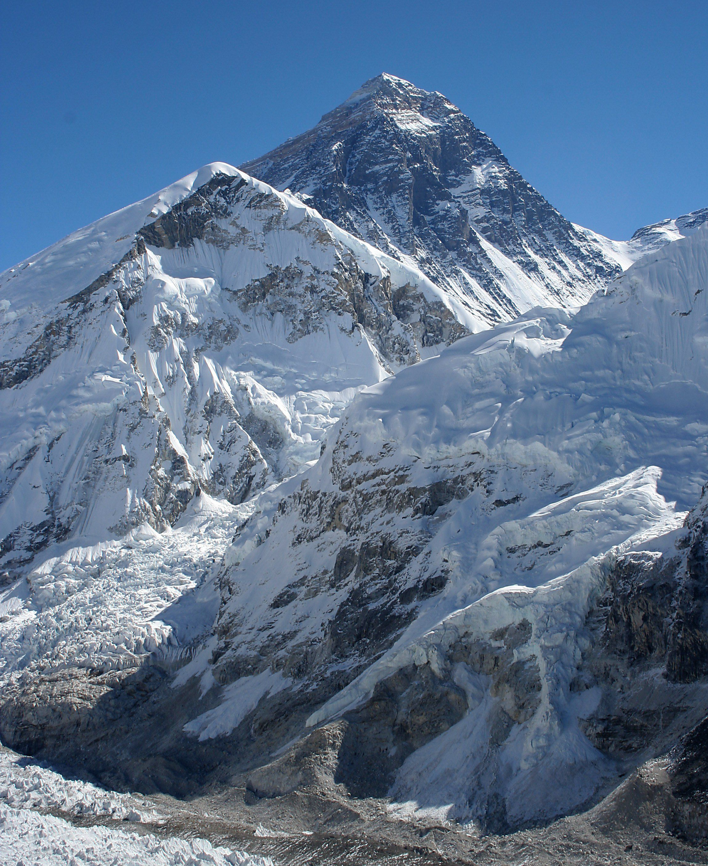
Highest above sea level, yes — 8,848.86 metres, a figure agreed jointly by Nepal and China in 2020 after separate surveys.
But it holds only one of three possible titles, and the other two go elsewhere.
Tallest from base to peak is Mauna Kea in Hawaii. Measured from its base on the sea floor it is about 10,200 metres, of which roughly 4,200 is above water. Everest starts from a plateau already several thousand metres up.
Furthest point from the Earth's centre is Chimborazo in Ecuador, at 6,263 metres. The Earth is not a sphere — it bulges at the equator by about 21 kilometres because of its rotation — and Chimborazo is almost on the equator while Everest is at 28 degrees north. Chimborazo's summit is about two kilometres further from the centre of the Earth than Everest's, and it is also the point on the surface closest to space.
Everest is still growing, by roughly 4 millimetres a year, as India continues into Asia. Its name in Nepali is Sagarmatha and in Tibetan Chomolungma; the English name honours George Everest, a British Surveyor General who never saw it and objected to the naming.
Why can nothing survive above 8,000 metres?
That region is called the death zone, and the reason is oxygen pressure rather than temperature or cold.
The percentage of oxygen in air is the same at every altitude — about 21 per cent. What changes is total air pressure. At the summit of Everest the pressure is roughly a third of sea level, so each breath delivers about a third of the oxygen molecules, and the pressure driving oxygen across the membranes in your lungs into your blood falls below what the body can compensate for.
The consequence is that the body cannot maintain itself. Digestion largely stops, so you cannot replace calories. Sleep is broken. Judgement degrades in a way climbers consistently describe as being unable to notice their own impairment. Fluid can leak into the lungs and brain. You are dying the entire time you are there, and the only treatment is to descend.
Acclimatisation over weeks helps considerably — the body makes more red cells and adjusts breathing — but it cannot bridge the gap above 8,000 metres. There are fourteen peaks above that height, all in the Himalayas and Karakoram.
Down
How deep is the deepest ocean?
The Challenger Deep in the Mariana Trench, at around 10,930 metres — deeper than Everest is tall, with over two kilometres to spare.
The pressure there is about 1,100 atmospheres, roughly a tonne pressed onto every square centimetre. It has been visited by humans three times as of the early 2020s: by Jacques Piccard and Don Walsh in the bathyscaphe Trieste in 1960, by James Cameron alone in 2012, and by Victor Vescovo's repeated dives from 2019.
More people have walked on the moon than have reached the bottom of the ocean.
Life is there. Amphipods, sea cucumbers and single-celled organisms have been recovered, and plastic bags and sweet wrappers have been photographed on the floor of the trench, which is the fact that tends to stay with people.
What is the deepest hole ever drilled?
The Kola Superdeep Borehole in north-west Russia, 12,262 metres, reached in 1989 after nearly twenty years.
It stopped because the rock got hot and started behaving like plastic. Temperatures at the bottom reached about 180 °C, well above the 100 °C predicted, and the rock became ductile enough to close around the drill bit and flow back into the hole. The project was abandoned in the 1990s and the hole is welded shut.
It produced genuine science: water was found at depths where none was expected, chemically bound in the rock and squeezed out; microscopic fossils were found at six kilometres; and the expected boundary between granite and basalt turned out not to exist — the rock was fractured granite all the way down, saturated with water.
The internet story about a "well to hell" with recorded screams is a hoax that began on a Christian radio broadcast in 1989.
Where is the lowest land?
The shore of the Dead Sea, at around 430 metres below sea level and dropping about a metre a year as the water evaporates faster than the Jordan River replenishes it — largely because the river is heavily diverted upstream.
Its salinity is around 34 per cent, roughly ten times ordinary seawater, which is why a person floats on it without effort: the water is dense enough that a human body displaces its own weight while still mostly above the surface.
The lowest point on land not covered by ice is the Bentley Subglacial Trench in Antarctica, at about 2,540 metres below sea level, buried under the ice sheet.
Long, large and dry
Which is the longest river?
Genuinely disputed, and the dispute is about where a river begins.
The Nile is traditionally given as the longest at about 6,650 kilometres, and the Amazon at about 6,400. But the Amazon's source has been reassigned several times as expeditions traced tributaries further into the Peruvian Andes, and a 2007 Brazilian expedition claimed a length that would make it longer. The Nile's own length changed when Lake Nasser flooded part of its course.
The difficulty is that a river's source is a choice. Do you follow the longest tributary, the one with the most water, or the one that shares the name? Different conventions give different answers, and no international body adjudicates.
On volume there is no argument at all. The Amazon discharges more water than the next several largest rivers combined — around a fifth of all the river water entering the world's oceans. Its plume of fresh water is detectable in the Atlantic hundreds of kilometres offshore.
Which is the largest desert?
Antarctica, and the answer is not a trick.
A desert is defined by precipitation, not by temperature or sand: less than about 250 millimetres a year. Much of Antarctica receives under 50 millimetres, and its interior is one of the driest places on Earth. At about 14 million square kilometres it is comfortably the largest.
The Sahara, at around 9 million square kilometres, is the largest hot desert — roughly the area of the United States. Only about a fifth of it is sand dunes; the rest is gravel plain, rock and mountain.
The Atacama in Chile is the driest non-polar desert, with some weather stations having recorded no rainfall at all in recorded history. It is dry because it sits between two rain shadows — the Andes block moisture from the Amazon and a coastal range blocks the Pacific — and a cold ocean current offshore suppresses evaporation. It is used as a Mars analogue for testing spacecraft instruments.
Antarctica's Dry Valleys are drier still, and are believed to have been free of rain for around two million years.
Which is the largest lake, and which the deepest?
The Caspian Sea is the largest by area at about 371,000 square kilometres — and whether it is a lake or a sea is a legal question worth billions, because different bodies of international law govern the division of a sea's resources and a lake's. Five countries border it and they argued for decades; a 2018 convention gave it a special status that is neither.
By volume and depth, Lake Baikal in Siberia is the record holder: 1,642 metres deep, and holding about 23 per cent of the world's unfrozen surface fresh water — more than all five North American Great Lakes combined. It is around 25 million years old, which makes it the oldest lake in existence, and the isolation has produced hundreds of species found nowhere else, including a freshwater seal.
Where is the wettest place on Earth?
Mawsynram and Cherrapunji, both in Meghalaya in north-east India, trade the title depending on the years compared. Mawsynram averages around 11,800 millimetres a year — close to twelve metres of rain.
The cause is the geometry described in 4.5: moist monsoon air sweeping north off the Bay of Bengal meets the Khasi Hills and is forced sharply upward, cooling and dumping its water on the windward slope.
Cherrapunji has a water shortage in the dry season, which sounds absurd and is not. The rain is concentrated into a few months, the slopes are steep so runoff is immediate, and deforestation has reduced the ground's ability to hold anything. The wettest place in the world runs out of drinking water every spring.
Extremes of temperature and population
What are the hottest and coldest recorded temperatures?
The highest reliably accepted air temperature is 56.7 °C at Furnace Creek in Death Valley, California, in 1913 — and even that is disputed by climatologists who suspect an observer error. Several recent readings around 54 °C in Death Valley and Kuwait are considered more solid.
The lowest recorded at the surface is −89.2 °C at Vostok Station in Antarctica in 1983. Satellite measurements of the ice surface have found patches down to around −98 °C, but that is skin temperature rather than air temperature.
The largest annual range is in Siberia. Verkhoyansk and Oymyakon have recorded around −68 °C in winter and above +37 °C in summer — a swing of more than a hundred degrees in the same village, which is the largest temperature range experienced by any permanently inhabited place.
Which is the most and least densely populated country?
Monaco is the most dense among sovereign states, at roughly 19,000 people per square kilometre in under two square kilometres. Singapore is the densest actual country of any size.
Mongolia is the least dense, at around two people per square kilometre — a country three times the size of France with a population smaller than many single cities, over a third of whom live in the capital.
For cities, definitions defeat comparison completely, because a city's population depends entirely on where you draw its boundary. Tokyo's metropolitan area is generally given as the largest urban agglomeration, at around 37 million, but the city proper is far smaller, and Delhi, Shanghai and Dhaka rank differently under different definitions. Dhaka is usually named the densest large city.
Which country spans the most time zones?
France, because of its overseas territories — twelve zones, from French Polynesia to Réunion. Russia has eleven, all contiguous, which is the more impressive fact.
China spans five geographical zones and uses one, as noted in 2.7.
The International Date Line does not run straight, because running it straight would put parts of a country on different dates. It bends around Russia's far east, around the Aleutians, and dramatically around Kiribati — which moved the line east in 1995 so that its whole territory shared a date, creating a bulge that made one of its islands the first place on Earth to see each new day.
The ones that are not what you think
Which is the largest island, and is Australia one?
Greenland, at about 2.16 million square kilometres. Australia is nearly four times larger and is classified as a continent rather than an island — a distinction with no scientific basis, decided by convention.
Around 80 per cent of Greenland is covered by an ice sheet up to three kilometres thick. The weight of it has pushed the underlying land below sea level in the centre, so if the ice melted, Greenland would initially be an archipelago around a central sea, before the land slowly rebounded over thousands of years.
Is the Great Wall of China visible from space?
No, and it is the most persistent geographical myth in existence.
The wall is long but narrow — a few metres wide — and built from local materials that match the surrounding terrain. From low Earth orbit, at around 400 kilometres, astronauts consistently report that it is not visible to the naked eye, and several have said so explicitly. Chinese astronaut Yang Liwei confirmed after his 2003 flight that he could not see it.
The claim predates spaceflight by decades, appearing in print in the 1930s, which is a useful reminder that a confidently repeated fact can circulate for a century without anybody having been in a position to check it.
Things that are visible from orbit include cities at night, large airports, reservoirs, and the wakes of ships.
Is Mount Everest the deadliest mountain?
No. By the ratio of deaths to successful summits, Annapurna I is the most lethal of the 8,000-metre peaks, historically killing roughly one climber for every three who reached the top, though the rate has improved. K2 is second and considerably harder to climb technically than Everest.
Everest has the most total deaths simply because it has by far the most attempts. Its fatality rate has fallen substantially — better forecasting, better equipment, supplementary oxygen and fixed ropes — while its crowding has produced a different hazard, queues in the death zone where the danger is time spent rather than difficulty.
What comes next
The next page is about names — why places are called what they are, which ones are mistakes, and which are the same word repeated in three languages by people who did not realise.